

Helsinki’s Waterfront Trail comprises both the built-up urban shorelines of the city centre and the mainly undeveloped shoreline of the suburbs. The Inner City Waterfront Trail is a 15-kilometer loop that will let you explore the diverse shorelines and marine environments around the centre of Helsinki. A signposted map has been published showing the entire route and the location of city bike stations, waterbuses and metro stations. The map also shows points of interest along the route, from architectural attractions to markets, including Finlandia Hall, the Kaisaniemi Botanic Garden and Hietaranta Beach.
Multifaceted trail reveals Helsinki’s maritime environment
The Inner City Waterfront Trail lets you witness and experience the city’s development, from the new residential and office buildings in its former port areas to all its architectural layers representing different decades and centuries. Maritime Helsinki also reveals its green parks, busy open-air markets and beautiful views of the sea and archipelago.
- Download: Map of Inner City Waterfront Trail (pdf)
- Signposted Inner City Waterfront Trail on the City of Helsinki’s online Map Service

Waterfront Trail to encompass all of Helsinki in the future
The City of Helsinki’s Maritime Strategy provides guidelines for developing services and enhancing the appeal of the archipelago and waterfront for the period up to 2030. The aim is to improve the availability of services and accessibility along the shoreline, to promote maritime events and to continue opening the nearby archipelago for recreational use.
The Waterfront Trail will be completed in its entirety in the coming years. The plan is to renovate and signpost all the sections in stages. The signposted waterfront trails will further enhance the appeal of Helsinki’s shorelines and promote the services available along the trails among both local residents and tourists. The trails will also encourage people to exercise and enjoy the outdoors. Unlike many other European capitals, Helsinki’s waterfront trails will be completely open to the public and within easy reach by public transport.
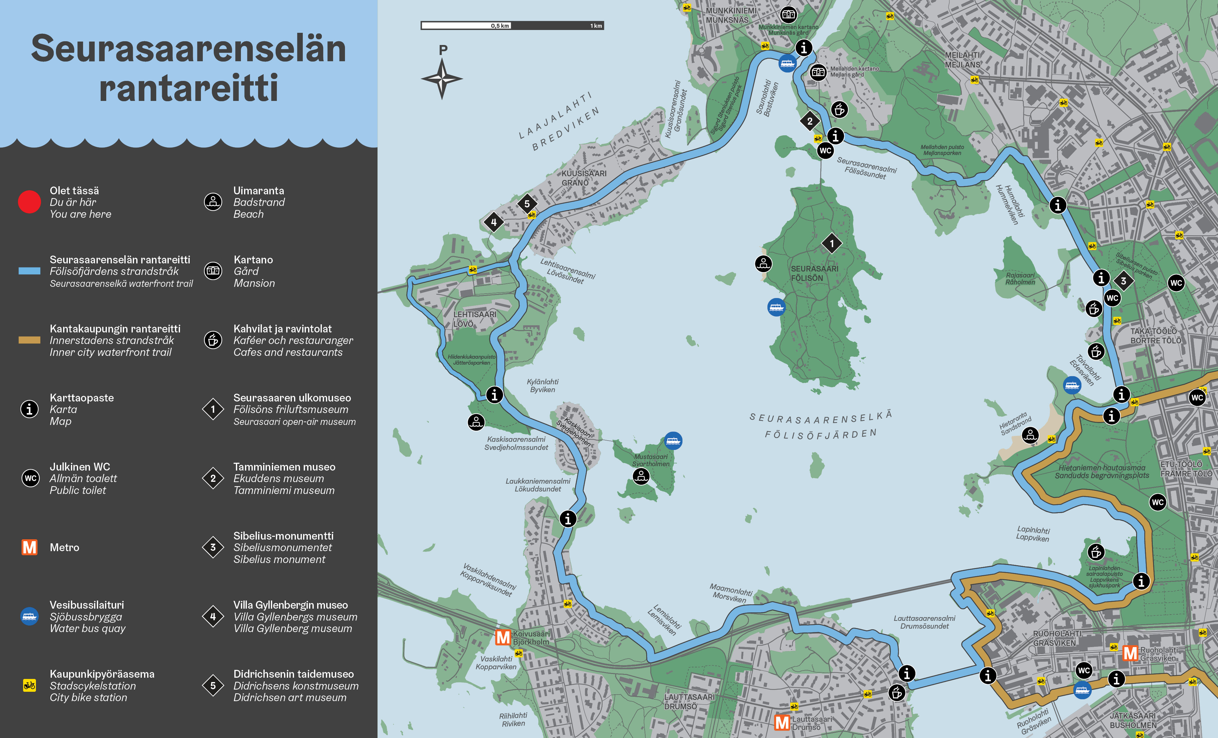
If you want to explore the Helsinki waterfront further, you can venture out to Eastern Helsinki (23 km from Kalasatama to Uutela) or to Seurasaari island region (14 km through four islands).
- Download: Map of Eastern Waterfront Trail (pdf)
- Download: Map of Seurasaarenselkä Waterfront Trail (pdf)